Remote Earth Sensing

Passive and active sensors mounted on crewless aerial vehicles to capture data about Earth systems through electromagnetic spectrums. It allows the detection, visualization, and analysis of objects and elements on the Earth’s surface. This technology could be used for more efficient land use.
BACK TO LIST
Technology Life Cycle

Technology Life Cycle

Maturity

Sales growth slows as the market becomes saturated. The technology is well-established and competition peaks, leading to price drops and marginal improvements.

Technology Readiness Level (TRL)

Technology Readiness Level (TRL)

Prototype Testing

Prototype is fully functional and ready for testing in industrially relevant environment.
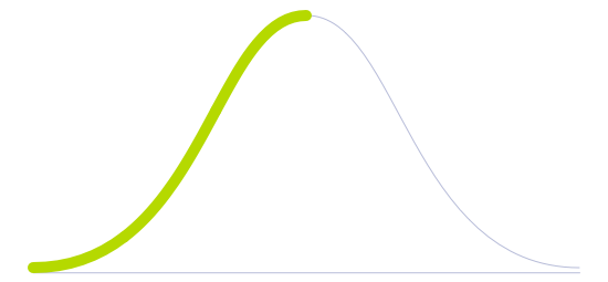
Technology Diffusion

Technology Diffusion

Early Majority

Adopts technologies once they are proven by Early Adopters. They prefer technologies that are well established and reliable.

Remote Earth Sensing

Better land surveying implies more efficient use of said land. Modern technologies, such as polarimetric radar attached to planes and drones, can do a better job of mapping vaster and deeper portions of the surface thanks to their more accurate sensors, decreased costs, and smaller dimensions. They mainly consist of radar detecting equipment with active sensors that transmit electromagnetic energy and record the reflection from objects on the Earth's surface. These multifunctional devices could detect large-scale vegetation changes, monitor pollution, or perform topographic mapping while also providing recordings of temperature, light levels, and other climate statistics.

Until now, 3D-scanning has mainly been used to create functional maps of indoor spaces, with high-resolution 3D images of real-world environments, including spectrographic details in near real-time. Due to its highly effective accuracy, this technology could be capable of potentially identifying and assessing the health of a specific leaf in a given forest. This sensing technology could be used in the future for sophisticated monitoring projects such as real-time ecosystem biodiversity determination, though it may also have applications as rapid response and assessment tools in disaster zones or unexplored environments.

A few more basic sensors are already in use, such as simple RGB cameras to monitor crops or animals and infrared cameras that detect early onset symptoms of stress or diseases. In addition, this technology could be useful in identifying ocean contaminants; plastic pollution is a growing problem for the world’s oceans. Airborne remote sensing using infrared imagery could help locate ocean plastic pollution since plastics have a characteristic infrared signature, providing an intermediate step until satellite sensing and detection improves. Currently, there are still issues related to flight duration, and the Synthetic Aperture Radar (SAR) used can be subject to inference by cloud movements.

Future Perspectives

The application of this technology will ultimately provide farmers with a more accurate decision support system (DSS), where reliable data related to possible issues with crops (or livestock) would be shown to anticipate highly relevant information that would typically be manually detected by an agronomist or farmer. This market opportunity would provide the farmer with advice and turn this anticipated information and action plan into a binary system that could link to a mobile phone to give warnings about rust infections among soy crops, for example, as well as the countermeasures needed to deal with the threat. Also, this technology would be a significant opportunity to sell the DSS packaged together with a proprietary consulting/management system.

While useful for farming applications, the technology would also enable real-time visualization and monitoring of life support conditions in urban environments, aiding in data capture and decision-making for preserving the quality of life in future cities.

Image generated by Envisioning using Midjourney

Sources
Remote sensing provides digital information on land and earth features that can be combined with spectral analysis and GIS modeling to create a powerful screening tool for transportation corridor or regional evaluation. Remote sensing can quickly and cost-effectively categorize and quantify land cover types (wetlands, crop lands, forested lands, etc.). When combined with topographic, environmental constraint, geological, and planimetric information, this data also can be used for quantitative description and evaluation of plan or project alternatives. Combining remote sensing and GIS capabilities offers the ability to present plan or project scenarios in a three-dimensional environment, providing decisionmakers and the public with a clear picture of potential impacts.
Conventional pollution monitoring strategies for heavy metals are often costly and unpractical. Innovative sampling and analytical approaches are therefore needed to efficiently monitor large areas. This study presents a novel, simple, fast, and inexpensive method to monitor heavy metal pollution that uses cation-exchange resin sachets and the micro-XRF core-scanning technique (XRF-CS). The resin passive samplers act as concentrators of cationic species and can be readily deployed spatially and temporally to record pollution signals. The large number of analytical tasks are then overcome by the fast and non-destructive XRF-CS to precisely assess elemental concentrations. Quantifying element loading involves direct comparison with a set of identically prepared and scanned resin reference standards containing Ca, Ti, Cr, Mn, Ni, Cu, Zn, Pb. The results show that within the test range (from 0–1000 s mg kg−1), the calibration lines have excellent regressions (R2 ≥ 0.97), even at the shortest exposure time (1 s). A pilot field survey of a suspected polluted area in central Taiwan, where 30 resin sachets had been deployed, identified a pollution hot spot in a rapid and economical manner. Therefore, this approach has the potential to become a valuable tool in environmental monitoring and forensics.
At CES 2016 in Las Vegas, Google announced a partnership with Lenovo to bring the first Project Tango smartphone to market. Here's what you need to know.
Synthetic Aperture Radar (SAR) is becoming more and more requested in the commercial and scientific world, especially considering the latest developme...
For researchers at the outside-the-box Media Lab brain trust, the future can be seen even in a sprinkling of sensors and video game software.
Plastic pollution is a large and growing problem for the world’s oceans. These petroleum-derived materials degrade slowly, threatening marine life and ecosystem processes. Plastic particles often coalesce into notorious patches in the upper 0.5 metres of ocean water, but the distribution of these patches on the marine surface and over time is unclear.
Earth Imaging Journal is a bimonthly magazine covering a range of earth observation and geospatial technologies and applications.
Tutorial on remotely-sensed data, from sensor characteristics, to different types of resolution, to data processing and analysis.
This video presents experimental results of autonomous navigation in confined indoor environments using an aerial robot. The robot is equipped with an IMU, camera, and laser scanner with deflective mirrors. All computations are performed onboard using a 1.6GHz atom processor. The robot is able to navigate autonomously in indoor or outdoor, GPS-denied environments.
Quality of urban environment directly affects people health, and it is important to understand the real-time status of urban air quality. Air quality monitoring, data analysis, and visualization can...
Remote sensing is the science of obtaining information without physically being there. The 3 most common methods of capture is airplane, satellite & drones.
Drought diagnosis and forecasting are fundamental issues regarding hydrological management in Spain, where recurrent water scarcity periods are

Interested in our research?

Read about our services for help with your foresight needs.
SERVICES