Spatial Computing

A software providing a bridge between the digital and physical world by mirroring in the digital realm human interaction in the physical world. Spatial computing can include IoT, digital twins, and robotics to improve machines’ spatial understanding, or even a user's augmented reality experience.
BACK TO LIST
Technology Life Cycle

Technology Life Cycle

R&D

Initial phase where new technologies are conceptualized and developed. During this stage, technical viability is explored and initial prototypes may be created.

Technology Readiness Level (TRL)

Technology Readiness Level (TRL)

Prototype Demonstration

Prototype is fully demonstrated in operational environment.
Technology Diffusion

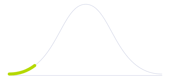
Technology Diffusion

Innovators

First to adopt new technologies. They are willing to take risks and are crucial to the initial testing and development of new applications.

Spatial Computing

Spatial computing is dedicated to providing a framework designed to blend technology into the world, encompassing virtual, augmented and mixed reality platforms. While VR places the user in another location, AR creates a new layer of digital content over the physical world. In the case of mixed reality, virtual objects are integrated into the natural world and, different from AR, these objects are responsive.

Spatial computing, therefore, is responsible for making hardware disappear by creating the perfect illusion of immersion as content adapts to the surroundings of the user, at the same time virtual spaces also feel like the natural world in the perception of the VR user. Spatial programming takes into consideration responsive techniques such as eye-controlled interactions based on the position of the user's head, working as a trigger for digital content. Hand gestures are also a method for interaction, either with the recognition of gestures in AR devices or with the help of specific controllers and haptic devices. Also, the user's voice can be used to activate digital content, similarly to what has already been experienced in the case of AI assistants.

Other devices and technologies that give support to spatial computing include 3D and camera sensors that capture information from the physical world, machine learning and AI. It works as a helpful tool to make programming more efficient, systems responsible for tracking physical changes and adapting them to digital content in real-time. Beyond games and the entertainment industry, spatial computing is making room in fields such as medicine (surgeries, for instance), logistics, mining, architecture, design, training, and so forth.

Future Perspectives

Adapting machine learning to spatial computing could bring new capabilities to cameras that are used to support spatial computing. In this sense, artificially intelligent virtual beings could interact with human users more effectively. They can appear in the natural world as holograms supported by mixed reality wearable devices or presented in virtual spaces through virtual reality. Social networks are also taking into consideration spatial computing as a means to create an authentic, virtual reality-based social space that could work as a substitute in many tasks, jobs or even social interactions.

Image generated by Envisioning using Midjourney

Sources
Welcome to the launch of our Spatial Computing Agency, Infinite Retina, which offers consulting services and research, a new video series, a new newsletter, a new podcast series, new industry databases (coming later this year), and a new book, coming in 2020. Along with our consulting services aimed at helping companies and entrepreneurs build new Spatial Computing projects and getting them funded and launched, we are very apt to helping everyone truly understand what the new paradigm of personal computing will be.
Spatial computing involves a radical change from how we interacted with the large, static computers of the past. Technological advances have now made it possible for us to operate computer technology in a host of new ways, and have opened up computers to new contexts and applications. Today, it is commonplace for us to speak to our devices via the voice, use gestures in Virtual or Augmented Reality environments, and carry technology around with us in wearable gadgets. This – and more – encompasses spatial computing.
The growing trend of using smartphones and other GPS-enabled devices has provided new opportunities for developing spatial computing applications and technologies in unanticipated and unprecedented ways. Some capabilities of today's smartphones highlight the potential of citizen sensors to enable the next generation of geoinformatics. One promising application area for this is social media and its application to disaster management. Dynamic, real-time incident information collected from onsite human responders about the extent of damage, the evolution of the event, the community's needs, and responders' ability to deal with the situation, combined with information from the larger emergency management community, could lead to more accurate and real-time situational awareness. This would enable informed decisions, better resource allocation and thus a better response and outcome to the total crisis. In this context, the US Department of Homeland Security's Science & Technology Directorate (DHS-S&T) has initiated the Social Media Alert and Response to Threats to Citizens" (SMART-C) program, which aims to develop citizen participatory sensing capabilities for decision support throughout the disaster life cycle via a multitude of devices and modalities. Here, the authors provide an overview of the envisioned SMART-C system's capabilities and discuss some of the interesting and unique challenges that arise due to the combination of spatial computing and social media within the context of disaster management.
Spatial computing broadly characterizes the technologies used to interact with 3D data, including IoT, digital twins, ambient computing, AI and robots.

Interested in our research?

Read about our services for help with your foresight needs.
SERVICES